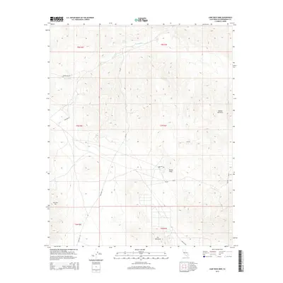
2015 Map of Camp Rock Mine
USGS Topo · Published 2015About this map
The Camp Rock Mine sits at the center of this 2015 survey, located within a high-elevation corridor of the Mojave Desert. The landscape is defined by the convergence of several major geological formations, including the Rodman Mountains to the northeast, the Fry Mountains to the south, and the prominent peak of East Ord Mtn in the southwest. This area serves as a critical drainage basin, where Kane Wash cuts through the northern sections of the map. The road network, consisting of Camp Rock Rd, Ord Mountain Rd, and the Canyon Route, illustrates the remote access required for mining operations and transit through these arid ranges. The map provides a precise look at the land partitions across multiple townships, including t7n r3e and t8n r2e, showing how the modern desert landscape remains shaped by its mineral resources and natural topography.
Find a feature on this map
16 named features on this map. Tap any name to fly to it.
Don’t see what you’re looking for? This feature index may not catch every label — zoom into the map to look around manually.
Map Details
Editions of this 2015 Camp Rock Mine Map
This is the sole edition of this map. No revisions or reprints were ever made.
Other maps of this area

1953 · San Bernardino
USGS Topo · 1:250,000

1955 · Silver Bell Mine
USGS Topo · 1:24,000

1955 · Newberry
USGS Topo · 1:62,500

1955 · Ord Mountains
USGS Topo · 1:62,500

1955 · Rodman Mountains
USGS Topo · 1:62,500

1956 · San Bernardino
USGS Topo · 1:250,000

1956 · Daggett
USGS Topo · 1:62,500

1957 · San Bernardino
USGS Topo · 1:250,000

1958 · San Bernardino
USGS Topo · 1:250,000

1959 · San Bernardino
USGS Topo · 1:250,000