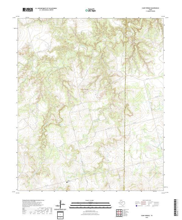
2022 Map of Camp Springs
USGS Topo · Published 2022About this map
Camp Springs is situated in a landscape defined by the intermittent drainages and breaks typical of West Texas, sitting near the boundary of Scurry and Fisher Counties. The area is characterized by a network of seasonal watercourses, including Camp Creek and Spring Creek, which navigate the terrain around Green Mountain. The settlement pattern is largely tied to agricultural and ranching operations, with a grid of county roads providing access to the more remote reaches of Horse Hollow and Gyp Draw. Local history is centered at the Camp Springs Cemetery, which serves as a primary genealogical landmark for the community. The presence of Dripping Spring highlights the importance of traditional water sources in this semi-arid region, where the relief is marked by numerous draws and creeks that feed into Deep Creek and Rough Creek.
Find a feature on this map
27 named features on this map. Tap any name to fly to it.
Don’t see what you’re looking for? This feature index may not catch every label — zoom into the map to look around manually.
Map Details
Editions of this 2022 Camp Springs Map
This is the sole edition of this map. No revisions or reprints were ever made.
Other maps of this area

1926 · Snyder 1-a
USGS Topo · 1:48,000

1932 · Camp Springs
USGS Topo · 1:62,500

1952 · Hermleigh
USGS Topo · 1:24,000

1954 · Lloyd Mountain
USGS Topo · 1:24,000

1954 · Big Spring
USGS Topo · 1:250,000

1958 · Big Spring
USGS Topo · 1:250,000

1969 · Camp Springs
USGS Topo · 1:24,000

1969 · Bull Creek
USGS Topo · 1:24,000

1969 · Inadale NW
USGS Topo · 1:24,000

1969 · Maverick Creek
USGS Topo · 1:24,000