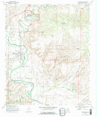
1969 Map of Camp Verde
USGS Topo · Published 1971About this map
Montezuma Castle National Monument and its preserved cliff dwellings overlook the valley of Beaver Creek in this late 1960s study. The Verde River serves as the primary hydrological artery, winding past the Lower Camp Verde Ind Res and the settlement of Camp Verde. This area highlights the transition from the high mesas of the Coconino National Forest to the rugged canyonlands of the Prescott National Forest. Local infrastructure such as the Camp Verde Airstrip and Camp Verde School support the community near the confluence of major waterways. Significant local history is preserved at the Clear Creek Cemetery and along the Old Military Reservation Boundary, tracing the region's heritage from ancient dwellings to 19th-century military footprints and mid-century ranching life.
Find a feature on this map
50 named features on this map. Tap any name to fly to it.
Don’t see what you’re looking for? This feature index may not catch every label — zoom into the map to look around manually.
Map Details
Editions of this 1969 Camp Verde Map
2 editions found
Other maps of this area

1887 · Verde
USGS Topo · 1:250,000

1892 · Verde
USGS Topo · 1:250,000

1923 · Camp Verde
USGS Topo · 1:125,000

1929 · Turret Peak
USGS Topo · 1:125,000

1932 · Camp Verde
USGS Topo · 1:125,000

1933 · Turret Peak
USGS Topo · 1:125,000

1936 · Camp Verde
USGS Topo · 1:125,000

1954 · Holbrook
USGS Topo · 1:250,000

1957 · Holbrook
USGS Topo · 1:250,000

1958 · Holbrook
USGS Topo · 1:250,000
Featured Places
- Camp Verde, AZ
- Yavapai County, AZ
- United States
- Jordan Meadows, Camp Verde
- Mountain View Estates, Camp Verde