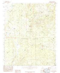
1986 Map of Camp Wood
USGS Topo · Published 1986About this map
Santa Maria Mountains dominate this high-elevation region of central Arizona, where the sprawling Prescott National Forest meets the unique land grant history of the Luis Maria Baca Float No 5. The landscape is a network of ridges and water resources essential for ranching and forest management, marked by numerous named catchments like McElhaney Tank and Camp Wood Corner Tank. The small settlement at Stringtown and the site at Camp Wood represent the thin human footprint in this wilderness, supported by a remote Landing Strip. Historically, the area's geography is defined by its springs and seeps, from Apache Springs in the north to Bear Trap Spring in the south. These water sources, combined with features like Stinson Mountain and Hyde Mountain, illustrate a terrain where topography dictated the paths of early travel and settlement.
Find a feature on this map
41 named features on this map. Tap any name to fly to it.
Don’t see what you’re looking for? This feature index may not catch every label — zoom into the map to look around manually.
Map Details
Editions of this 1986 Camp Wood Map
2 editions found
Other maps of this area

1887 · Prescott
USGS Topo · 1:250,000

1892 · Prescott
USGS Topo · 1:250,000

1923 · Signal
USGS Topo · 1:250,000

1942 · Signal
USGS Topo · 1:250,000

1945 · Bagdad
USGS Topo · 1:62,500

1947 · Sheridan Mountain
USGS Topo · 1:62,500

1947 · Camp Wood
USGS Topo · 1:62,500

1948 · Sheridan Mountain
USGS Topo · 1:63,360

1948 · Camp Wood
USGS Topo · 1:63,360

1948 · Bagdad
USGS Topo · 1:62,500