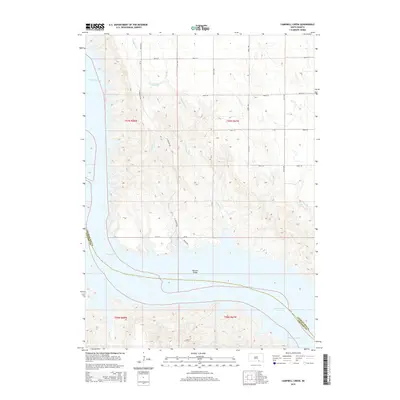
2015 Map of Campbell Creek
USGS Topo · Published 2015About this map
Missouri River water levels and the wide expanse of Lake Francis Case dominate this landscape along the border of Charles Mix and Gregory Counties. The map reveals the critical crossing of the Wheeler Bridge, which links the eastern and western sections of the region near the junction of N Wheeler Rd and S Wheeler Rd.
Find a feature on this map
25 named features on this map. Tap any name to fly to it.
Don’t see what you’re looking for? This feature index may not catch every label — zoom into the map to look around manually.
Map Details
Editions of this 2015 Campbell Creek Map
This is the sole edition of this map. No revisions or reprints were ever made.
Other maps of this area

1955 · Mitchell
USGS Topo · 1:250,000

1959 · Mitchell
USGS Topo · 1:250,000

1964 · Campbell Creek
USGS Topo · 1:24,000

1964 · Whetstone Bay
USGS Topo · 1:24,000

1964 · Lake Andes NW
USGS Topo · 1:24,000

1964 · Lake Andes SW
USGS Topo · 1:24,000
1964 · South Scalp Creek
USGS Topo · 1:24,000
1964 · Bonesteel
USGS Topo · 1:24,000

1977 · Lake Andes NW
USGS Topo · 1:24,000
1977 · Lake Andes SW
USGS Topo · 1:24,000