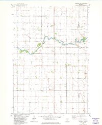
1981 Map of Campbell NE
USGS Topo · Published 1981About this map
The Otter Tail River winds through the heart of this agricultural landscape in the early 1980s, marking the transition between Foxhome and Bradford townships. This survey captures a highly managed water system where the natural river course is supplemented by extensive drainage engineering, including Judicial Ditch No 1 and Judicial Ditch No 10. These features reflect the region's historical commitment to land reclamation for farming. Local social and civic centers are concentrated at the Vukku Ch and the adjacent Vukku Ch Cem, while the simple label Townhall near the border of Western township indicates the hub of local governance. The presence of a Gravel Pit along the eastern edge suggests the minor industrial extraction necessary for road maintenance and development in this rural corner of Minnesota.
Find a feature on this map
12 named features on this map. Tap any name to fly to it.
Don’t see what you’re looking for? This feature index may not catch every label — zoom into the map to look around manually.
Map Details
Editions of this 1981 Campbell NE Map
This is the sole edition of this map. No revisions or reprints were ever made.
Other maps of this area

1910 · Wendell
USGS Topo · 1:62,500

1913 · Fergus Falls
USGS Topo · 1:62,500

1913 · Wendell
USGS Topo · 1:62,500

1919 · Rothsay
USGS Topo · 1:62,500

1951 · Rothsay
USGS Topo · 1:62,500

1951 · Campbell
USGS Topo · 1:62,500

1953 · Fargo
USGS Topo · 1:250,000

1956 · Fargo
USGS Topo · 1:250,000

1966 · Carlisle
USGS Topo · 1:24,000
1973 · Stony Lake
USGS Topo · 1:24,000