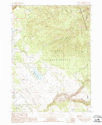
1988 Map of Campbell Reservoir
USGS Topo · Published 1988About this map
Fremont National Forest and the Gearhart Mountain Wilderness dominate this high-desert terrain on the border of Klamath and Lake Counties. The landscape is a network of water management and high-country landmarks, centered on Campbell Reservoir and the nearby Obenchain Reservoir. Evidence of early transportation and infrastructure is found in the Old Railroad Grade and a modern Micro Wave Reflector situated above the South Fork Sprague River. Named meadows and flats, including Keddy Field and Swede Cabin Flat, suggest a history of seasonal grazing or early homesteading. The hydrology of the area is particularly detailed, tracing the headwaters of the Brownsworth River and numerous high-elevation water sources such as Whisky Spring and Butte Spring.
Find a feature on this map
38 named features on this map. Tap any name to fly to it.
Don’t see what you’re looking for? This feature index may not catch every label — zoom into the map to look around manually.
Map Details
Editions of this 1988 Campbell Reservoir Map
This is the sole edition of this map. No revisions or reprints were ever made.
Other maps of this area

1889 · Klamath
USGS Topo · 1:250,000

1894 · Klamath
USGS Topo · 1:250,000

1955 · Klamath Falls
USGS Topo · 1:250,000

1958 · Klamath Falls
USGS Topo · 1:250,000

1960 · Riverbed Butte
USGS Topo · 1:62,500

1960 · Bly
USGS Topo · 1:62,500

1960 · Fishhole Mtn
USGS Topo · 1:62,500

1966 · Sandhill Crossing
USGS Topo · 1:24,000

1966 · Lee Thomas Crossing
USGS Topo · 1:24,000

1974 · Lake Abert
USGS Topo · 1:100,000