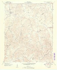
1951 Map of Campbells Station
USGS Topo · Published 1951About this map
Campbells Station serves as a central point in this 1951 topographic study of rural Middle Tennessee, where the Louisville and Nashville Railroad cuts through the terrain near Dodson Siding. The landscape is defined by the sharp divide of Elk Ridge, separating the drainage of Fountain Creek to the north from the intricate system of hollows to the south. This area, spanning the borders of Maury, Marshall, and Giles counties, remains largely agrarian, evidenced by the high density of family cemeteries such as Ballanfant Cem and Holt Cem, alongside small community hubs like Culleoka. Local education and faith are anchored by landmarks like the Mooresville School and Lowery Chapel, while the presence of a Telephone line following the eastern roads indicates the gradual reach of mid-century infrastructure into these valleys.
Find a feature on this map
86 named features on this map. Tap any name to fly to it.
Don’t see what you’re looking for? This feature index may not catch every label — zoom into the map to look around manually.
Map Details
Editions of this 1951 Campbells Station Map
3 editions found
Other maps of this area

1901 · Colombia
USGS Topo · 1:125,000

1936 · Milky Way
USGS Topo · 1:24,000

1936 · Cornersville
USGS Topo · 1:24,000

1936 · Lewisburg
USGS Topo · 1:24,000

1936 · Brick Church
USGS Topo · 1:24,000

1936 · Verona
USGS Topo · 1:24,000

1936 · Campbells Station
USGS Topo · 1:24,000

1936 · Glendale
USGS Topo · 1:24,000

1936 · Columbia
USGS Topo · 1:24,000

1936 · Lynnville
USGS Topo · 1:24,000