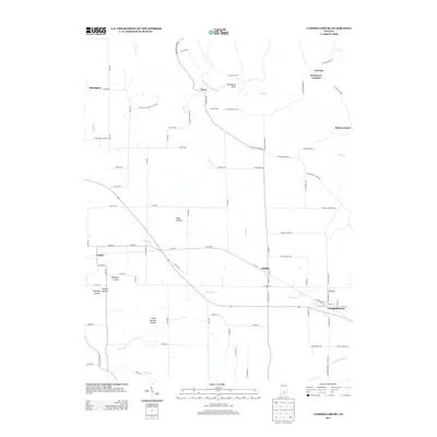
2013 Map of Campbellsburg
USGS Topo · Published 2013About this map
The E Fork White River carves a sharp loop at Horseshoe Bend near the settlement of Bono, defining the northern landscape of this region. To the south, the terrain transitions into a network of distinct hollows, including Frank Garrett Hollow, Shantaky Hollow, and Bane Hollow. This area is characterized by small, concentrated settlements and a rural road system that follows the natural topography of the river valleys and creek beds.
Find a feature on this map
90 named features on this map. Tap any name to fly to it.
Don’t see what you’re looking for? This feature index may not catch every label — zoom into the map to look around manually.
Map Details
Editions of this 2013 Campbellsburg Map
This is the sole edition of this map. No revisions or reprints were ever made.
Other maps of this area

1934 · Bedford
USGS Topo · 1:48,000

1937 · Bedford
USGS Topo · 1:62,500

1950 · Becks Mill
USGS Topo · 1:24,000

1950 · Mitchell
USGS Topo · 1:24,000

1951 · Smedley
USGS Topo · 1:24,000

1956 · Vincennes
USGS Topo · 1:250,000

1957 · Vincennes
USGS Topo · 1:250,000

1957 · Campbellsburg
USGS Topo · 1:24,000

1957 · Livonia
USGS Topo · 1:24,000
1957 · Paoli
USGS Topo · 1:24,000