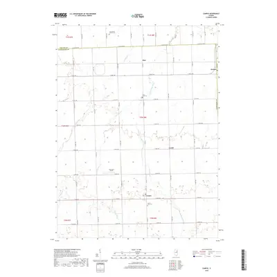
2018 Map of Campus
USGS Topo · Published 2018About this map
Campus and the surrounding prairie of northeastern Livingston County are defined by a rigorous grid of section lines and township roads. This landscape reflects the agricultural heritage of the region, where small settlements like Blair, Reddick, and Cardiff serve as local anchors. The map reveals the intricate drainage patterns of the area, specifically where Broughton Creek and the East Fork Mazon River move through the farmland. Family history is preserved in several rural burial grounds, including Sacred Heart Cemetery south of Campus and Round Grove Cemetery further north. The presence of Aero Acres Airport near Gooseberry Creek highlights the more modern transportation infrastructure layered over the historical rural townships of T30N R8E and T31N R8E.
Find a feature on this map
28 named features on this map. Tap any name to fly to it.
Don’t see what you’re looking for? This feature index may not catch every label — zoom into the map to look around manually.
Map Details
Editions of this 2018 Campus Map
This is the sole edition of this map. No revisions or reprints were ever made.
Other maps of this area

1923 · Herscher
USGS Topo · 1:62,500

1925 · Herscher
USGS Topo · 1:62,500

1944 · Piper City
USGS Topo · 1:48,000

1947 · Piper City
USGS Topo · 1:62,500

1947 · Cullom
USGS Topo · 1:62,500

1948 · Dwight
USGS Topo · 1:62,500

1949 · Cullom
USGS Topo · 1:62,500

1950 · Dwight
USGS Topo · 1:62,500

1958 · Aurora
USGS Topo · 1:250,000

1958 · Peoria
USGS Topo · 1:250,000