2024 Map of Campus
USGS Topo · Published 2024About this map
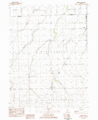
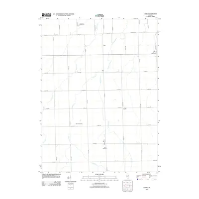
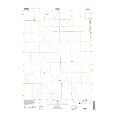
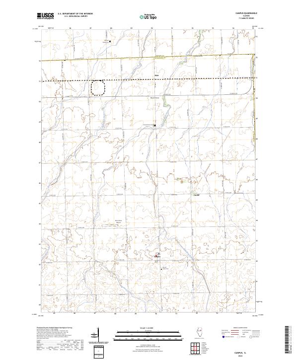
The Campus settlement sits at the intersection of Co HWY 3 and E 2700 N RD, serving as a central point in this prairie landscape along the border of GrundY and Livingston counties. The area is defined by its agricultural grid and the winding paths of Gooseberry Creek and Broughton Creek. Further north, the East Fork Mazon River cuts through the terrain near the small clusters of Blair and Round Grove. Genealogists will find several significant burial sites, including Gardner Prairie Cem near the northern boundary and Sacred Heart Cem just south of Campus. The presence of Cardiff and the Aero Acres Airport illustrates the continued use of this rural corridor for both residence and light aviation. The map reflects a stabilized rural geography where section lines dictate the road network, preserving the footprints of these long-standing Illinois communities.
Find a feature on this map
35 named features on this map. Tap any name to fly to it.
Don’t see what you’re looking for? This feature index may not catch every label — zoom into the map to look around manually.
Map Details
Editions of this 2024 Campus Map
This is the sole edition of this map. No revisions or reprints were ever made.
Historical Maps of Campus Through Time
6 maps found