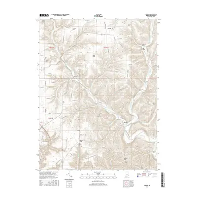
2016 Map of Canaan
USGS Topo · Published 2016About this map
Indian Kentucky Creek and its many winding tributaries, including the West Fork Indian Kentucky Creek and Razor Fork, define the drainage patterns of this eastern Jefferson County landscape. Small rural communities like Canaan and Manville serve as anchors for a network of ridge-top roads and deep hollows. The settlement pattern follows the high ground of Copeland Ridge, Bacon Ridge, and Halls Ridge, where agricultural fields meet the steep, wooded descents of Owl Hollow and Blacksnake Hollow.
Find a feature on this map
89 named features on this map. Tap any name to fly to it.
Don’t see what you’re looking for? This feature index may not catch every label — zoom into the map to look around manually.
Map Details
Editions of this 2016 Canaan Map
This is the sole edition of this map. No revisions or reprints were ever made.
Other maps of this area

1939 · Madison West
USGS Topo · 1:24,000

1943 · Brooksburg
USGS Topo · 1:24,000

1948 · Madison West
USGS Topo · 1:24,000

1953 · Madison West
USGS Topo · 1:24,000

1953 · Carrollton
USGS Topo · 1:24,000

1953 · Madison East
USGS Topo · 1:24,000

1956 · Clifty Falls
USGS Topo · 1:24,000

1956 · Bennington
USGS Topo · 1:24,000

1956 · Canaan
USGS Topo · 1:24,000

1956 · Louisville
USGS Topo · 1:250,000