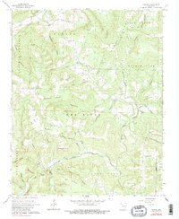
1962 Map of Canaan
USGS Topo · Published 1983About this map
Canaan and Kay anchor this 1962 topographic landscape, situated along the rugged boundary where Searcy and Van Buren counties meet. The geography is defined by the winding course of the Little Red River and its Middle Fork, which carve through the Ozark highlands. The settlement pattern is largely dictated by these drainage systems, with homesteads and community structures following the fertile hollows.
Find a feature on this map
50 named features on this map. Tap any name to fly to it.
Don’t see what you’re looking for? This feature index may not catch every label — zoom into the map to look around manually.
Map Details
Editions of this 1962 Canaan Map
3 editions found
Other maps of this area

1879 · Washington
USGS Topo · 1:62,500

1887 · Smyrna
USGS Topo · 1:62,500

1889 · Marshall #3
USGS Topo · 1:62,500

1892 · Marshall
USGS Topo · 1:125,000

1894 · Marshall
USGS Topo · 1:125,000

1901 · Marshall
USGS Topo · 1:125,000

1939 · Snowball
USGS Topo · 1:62,500

1940 · Smyrna
USGS Topo · 1:62,500

1941 · Snowball
USGS Topo · 1:62,500

1942 · Snowball
USGS Topo · 1:62,500