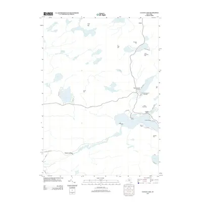
2013 Map of Canada Lake
USGS Topo · Published 2013About this map
Canada Lake and its surrounding mountain peaks anchor this study of the southern Adirondacks during the early twenty-first century. The landscape is defined by its complex network of water bodies, ranging from the large Pleasant Lake and Stoner Lakes to smaller basins like Goose Egg Lake and Nine Corner Lake. Human activity centers on seasonal recreation and lakeside settlements, notably at Arietta in the northeast and Stewart Landing along Sprite Cr to the south.
Find a feature on this map
55 named features on this map. Tap any name to fly to it.
Don’t see what you’re looking for? This feature index may not catch every label — zoom into the map to look around manually.
Map Details
Editions of this 2013 Canada Lake Map
This is the sole edition of this map. No revisions or reprints were ever made.
Other maps of this area

1901 · Lassellsville
USGS Topo · 1:62,500

1903 · Gloversville
USGS Topo · 1:62,500

1903 · Lassellsville
USGS Topo · 1:62,500

1904 · Piseco Lake
USGS Topo · 1:62,500

1906 · Piseco Lake
USGS Topo · 1:62,500

1907 · Lake Pleasant
USGS Topo · 1:62,500

1908 · Piseco Lake
USGS Topo · 1:62,500

1943 · Gloversville
USGS Topo · 1:62,500
1945 · Stratford
USGS Topo · 1:24,000

1945 · Caroga Lake
USGS Topo · 1:24,000