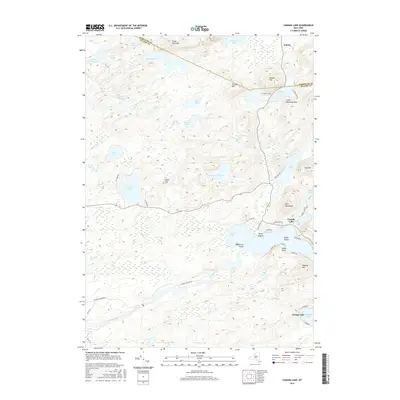
2016 Map of Canada Lake
USGS Topo · Published 2016About this map
Canada Lake and the southern Adirondack foothills define this landscape at the border of Hamilton and Fulton counties. The area is characterized by a dense network of water bodies and high points, including the Kane Mountains and Good Luck Mtn. While the settlements of Canada Lake and Caroga Lake serve as primary hubs, smaller points like Point Breeze and the crossroads at Arietta anchor the local geography. The map reveals a complex hydrography where Sprite Creek and Moose Creek navigate the terrain between numerous named basins such as Broomstick Lake, Nine Corner Lake, and Stoner Lakes. Evidence of local industry and water management appears at Waters Millpond, while geographic curiosities like Stoner Island and the Burnt Vly indicate the varied wetland and island features found throughout this lake-heavy region.
Find a feature on this map
61 named features on this map. Tap any name to fly to it.
Don’t see what you’re looking for? This feature index may not catch every label — zoom into the map to look around manually.
Map Details
Editions of this 2016 Canada Lake Map
This is the sole edition of this map. No revisions or reprints were ever made.
Other maps of this area

1901 · Lassellsville
USGS Topo · 1:62,500

1903 · Gloversville
USGS Topo · 1:62,500

1903 · Lassellsville
USGS Topo · 1:62,500

1904 · Piseco Lake
USGS Topo · 1:62,500

1906 · Piseco Lake
USGS Topo · 1:62,500

1907 · Lake Pleasant
USGS Topo · 1:62,500

1908 · Piseco Lake
USGS Topo · 1:62,500

1943 · Gloversville
USGS Topo · 1:62,500
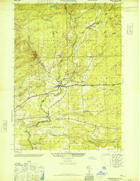
1945 · Stratford
USGS Topo · 1:24,000

1945 · Caroga Lake
USGS Topo · 1:24,000