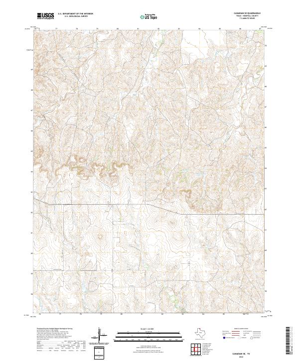
2022 Map of Canadian SE
USGS Topo · Published 2022About this map
Brown Ranch and the surrounding drainage basins of Hemphill County define this corner of the Texas Panhandle. The landscape is heavily marked by the erosive paths of McKay Cr and Big Timber Creek, which carve through the high plains toward the Canadian River valley. The presence of Cleveland Lake provides a rare permanent water feature in this arid region, while the network of county roads like Charley Brown Rd and Ranch Rd 3044 illustrates the rural infrastructure supporting local ranching operations. The terrain is characterized by intricate contouring, particularly around Elk Creek and Major Cr, showing the complex topography that dictates movement and settlement in this portion of the Texas Panhandle.
Find a feature on this map
18 named features on this map. Tap any name to fly to it.
Don’t see what you’re looking for? This feature index may not catch every label — zoom into the map to look around manually.
Map Details
Editions of this 2022 Canadian SE Map
This is the sole edition of this map. No revisions or reprints were ever made.
Other maps of this area

1954 · Amarillo
USGS Topo · 1:250,000

1958 · Amarillo
USGS Topo · 1:250,000

1967 · Mendota
USGS Topo · 1:24,000

1967 · Dads Creek
USGS Topo · 1:24,000

1967 · Lake June
USGS Topo · 1:24,000

1967 · Young Ranch
USGS Topo · 1:24,000

1967 · Blue Ridge School
USGS Topo · 1:24,000

1967 · Canadian SE
USGS Topo · 1:24,000

1972 · Canadian West
USGS Topo · 1:24,000

1972 · Canadian East
USGS Topo · 1:24,000