
1972 Map of Canadian East
USGS Topo · Published 1974About this map
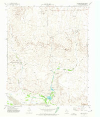
The Canadian River dominates this Panhandle landscape, its wide, braided bed carving through the rolling ranchlands of Hemphill County. In the early 1970s, the area around the town of Canadian serves as a critical junction for the Atchison Topeka and Santa Fe Railroad, which parallels the river valley. The map reveals a working land of energy and conservation, where the Gene Howe Wildlife Management Area provides protected terrain alongside active extraction sites like Oil Wells and Gas Wells.
Find a feature on this map
28 named features on this map. Tap any name to fly to it.
Don’t see what you’re looking for? This feature index may not catch every label — zoom into the map to look around manually.
Map Details
Editions of this 1972 Canadian East Map
This is the sole edition of this map. No revisions or reprints were ever made.
Other maps of this area

1954 · Perryton
USGS Topo · 1:250,000

1954 · Amarillo
USGS Topo · 1:250,000

1958 · Perryton
USGS Topo · 1:250,000

1958 · Amarillo
USGS Topo · 1:250,000

1967 · Mendota
USGS Topo · 1:24,000

1967 · Blue Ridge School
USGS Topo · 1:24,000

1967 · Canadian SE
USGS Topo · 1:24,000

1972 · Canadian West
USGS Topo · 1:24,000

1972 · Glazier
USGS Topo · 1:24,000
1972 · Lake Marvin
USGS Topo · 1:24,000