
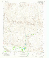
1972 Map of Glazier
USGS Topo · Published 1974About this map
Glazier anchors the southeastern corner of this survey, situated where the Atchison Topeka and Santa Fe railroad cuts across the Panhandle landscape. The map reveals a transition between the organized industrial presence of the Oil and Gas Field and the complex drainage networks of the Canadian River watershed. North of the town, the land is marked by numerous oil wells and a significant Pipeline, alongside smaller settlements like Tubbs and Locust Grove.
Find a feature on this map
24 named features on this map. Tap any name to fly to it.
Don’t see what you’re looking for? This feature index may not catch every label — zoom into the map to look around manually.
Map Details
Editions of this 1972 Glazier Map
This is the sole edition of this map. No revisions or reprints were ever made.
Other maps of this area

1954 · Perryton
USGS Topo · 1:250,000

1954 · Amarillo
USGS Topo · 1:250,000

1958 · Perryton
USGS Topo · 1:250,000

1958 · Amarillo
USGS Topo · 1:250,000

1972 · Barton Corners
USGS Topo · 1:24,000

1972 · Canadian West
USGS Topo · 1:24,000

1972 · Canadian East
USGS Topo · 1:24,000

1972 · Willow Creek
USGS Topo · 1:24,000
1972 · Lake Marvin
USGS Topo · 1:24,000

1972 · Lipscomb
USGS Topo · 1:24,000