
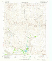
1967 Map of Canadian SE
USGS Topo · Published 1970About this map
Big Timber Creek and its many tributaries carve through the canyonlands of Hemphill County in this late-1960s survey. The landscape is defined by the cattle-ranching culture of the Texas Panhandle, evidenced by the numerous fence lines and small crossroads settlements that dot the high plains. Small communities like Needmore and Needa sit along the primary roadway, while a major Pipeline cuts across the terrain, reflecting the region's energy infrastructure.
Find a feature on this map
8 named features on this map. Tap any name to fly to it.
Don’t see what you’re looking for? This feature index may not catch every label — zoom into the map to look around manually.
Map Details
Editions of this 1967 Canadian SE Map
This is the sole edition of this map. No revisions or reprints were ever made.
Other maps of this area

1954 · Amarillo
USGS Topo · 1:250,000

1958 · Amarillo
USGS Topo · 1:250,000

1967 · Mendota
USGS Topo · 1:24,000

1967 · Dads Creek
USGS Topo · 1:24,000

1967 · Lake June
USGS Topo · 1:24,000

1967 · Young Ranch
USGS Topo · 1:24,000

1967 · Blue Ridge School
USGS Topo · 1:24,000

1972 · Canadian West
USGS Topo · 1:24,000

1972 · Canadian East
USGS Topo · 1:24,000
1972 · Lake Marvin
USGS Topo · 1:24,000