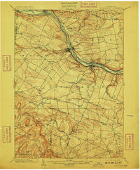
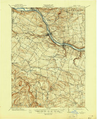
1902 Map of Canajoharie
USGS Topo · Published 1909About this map
The Mohawk River corridor serves as the industrial and transportation spine of this Montgomery County landscape, where the historic Erie Canal runs parallel to major turn-of-the-century rail lines. Busy river towns like Ft. Plain, Canajoharie, and St. Johnsville anchor the valley, showing the dense concentration of infrastructure provided by the New York Central and Hudson River R. R. and the West Shore R. R..
Find a feature on this map
58 named features on this map. Tap any name to fly to it.
Don’t see what you’re looking for? This feature index may not catch every label — zoom into the map to look around manually.
Map Details
Editions of this 1902 Canajoharie Map
6 editions found
Other maps of this area

1896 · Fonda
USGS Topo · 1:62,500

1898 · Fonda
USGS Topo · 1:62,500

1898 · Canajoharie
USGS Topo · 1:62,500

1898 · Schoharie
USGS Topo · 1:62,500

1900 · Little Falls
USGS Topo · 1:62,500

1900 · Canajoharie
USGS Topo · 1:62,500

1900 · Schoharie
USGS Topo · 1:62,500

1901 · Lassellsville
USGS Topo · 1:62,500

1902 · Canajoharie
USGS Topo · 1:62,500

1902 · Fonda
USGS Topo · 1:62,500