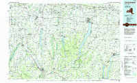
1983 Map of Canandaigua
USGS Topo · Published 1985About this map
Canandaigua Lake and the Finger Lakes region define the central geography of this 1983 planimetric survey, which illustrates the complex water systems and transport corridors of the western Genesee Valley. The map traces the long north-south basins of Conesus Lake, Hemlock Lake, Canadice Lake, and Honeoye Lake, showing the intricate drainage through Canaseraga Creek and the Genesee River. Human impact on the terrain is evident at the Mount Morris Dam and across the extensive road network that includes the N.Y. State Thruway.
Find a feature on this map
245 named features on this map. Tap any name to fly to it.
Don’t see what you’re looking for? This feature index may not catch every label — zoom into the map to look around manually.
Map Details
Editions of this 1983 Canandaigua Map
2 editions found
Other maps of this area

1895 · Rochester
USGS Topo · 1:62,500

1897 · Albion
USGS Topo · 1:62,500

1898 · Rochester
USGS Topo · 1:62,500

1898 · Watkins Glen
USGS Topo · 1:62,500

1899 · Brockport
USGS Topo · 1:62,500

1899 · Palmyra
USGS Topo · 1:62,500

1900 · Macedon
USGS Topo · 1:62,500

1900 · Naples
USGS Topo · 1:62,500

1900 · Canandaigua
USGS Topo · 1:62,500

1901 · Watkins
USGS Topo · 1:62,500