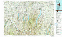
1983 Map of Canandaigua
USGS Topo · Published 1993About this map
Canandaigua Lake and the surrounding glacial fingers dominate this topographic landscape during the early 1980s. The region is defined by deep north-south valleys and a robust agricultural economy, anchored by the State Agricultural Experiment Station near Geneva. The map captures the transportation corridor of the New York State Thruway and the Conrail lines as they cut through established towns like Canandaigua, Le Roy, and Clifton Springs.
Find a feature on this map
67 named features on this map. Tap any name to fly to it.
Don’t see what you’re looking for? This feature index may not catch every label — zoom into the map to look around manually.
Map Details
Editions of this 1983 Canandaigua Map
2 editions found
Other maps of this area

1895 · Rochester
USGS Topo · 1:62,500

1897 · Albion
USGS Topo · 1:62,500

1898 · Rochester
USGS Topo · 1:62,500

1898 · Watkins Glen
USGS Topo · 1:62,500

1899 · Brockport
USGS Topo · 1:62,500

1899 · Palmyra
USGS Topo · 1:62,500

1900 · Macedon
USGS Topo · 1:62,500

1900 · Naples
USGS Topo · 1:62,500

1900 · Canandaigua
USGS Topo · 1:62,500

1901 · Watkins
USGS Topo · 1:62,500