1964 Map of Canaseraga
USGS Topo · Published 1965About this map
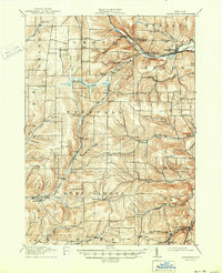
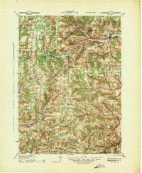
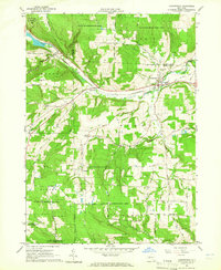
Canaseraga serves as the focal point of this mid-century topographic study, situated where the Erie-Lackawanna Railroad follows the valley of Canaseraga Creek. The village layout includes the Central Sch and several small cemeteries, including St Marys Cem, reflecting a settled valley floor surrounded by high, timbered ridges. Much of the upland terrain is dedicated to the State Reforestation Area, indicating a landscape transitioning from earlier agricultural use back to forest cover by the early 1960s.
Find a feature on this map
63 named features on this map. Tap any name to fly to it.
Don’t see what you’re looking for? This feature index may not catch every label — zoom into the map to look around manually.
Map Details
Editions of this 1964 Canaseraga Map
This is the sole edition of this map. No revisions or reprints were ever made.
Historical Maps of Almond Through Time
8 maps found