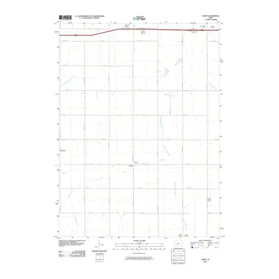
2010 Map of Canby
USGS Topo · Published 2010About this map
Canby and the surrounding township in Adair County are defined by a network of rural roads and the meandering courses of the Middle Nodaway River and its tributaries. This agricultural landscape is anchored by quiet settlements and historic sites like Prussia Centre and Linwood. The map reveals a high concentration of small community burial grounds, including Saint Josephs Cemetery, Oakwood Cemetery, and the Immanuel Lutheran Cemetery, which serve as vital markers for genealogical research in this part of Iowa. Waterways like Ninemile Creek, North Turkey Creek, and Rutt Branch cut through the sections, illustrating the drainage patterns that have shaped local farming for generations. The northern edge is dominated by modern infrastructure, featuring the Adair West Bound Rest Area and Adair East Bound Rest Area along the interstate, contrasting with the slower pace of the interior section lines.
Find a feature on this map
32 named features on this map. Tap any name to fly to it.
Don’t see what you’re looking for? This feature index may not catch every label — zoom into the map to look around manually.
Map Details
Editions of this 2010 Canby Map
This is the sole edition of this map. No revisions or reprints were ever made.
Other maps of this area

1952 · Panora
USGS Topo · 1:62,500

1954 · Greenfield
USGS Topo · 1:62,500

1954 · Omaha
USGS Topo · 1:250,000

1957 · Omaha
USGS Topo · 1:250,000

1958 · Omaha
USGS Topo · 1:250,000

1971 · Adair South
USGS Topo · 1:24,000

1971 · Fontanelle
USGS Topo · 1:24,000

1971 · Canby
USGS Topo · 1:24,000

1971 · Casey
USGS Topo · 1:24,000

1971 · Fontanelle SW
USGS Topo · 1:24,000