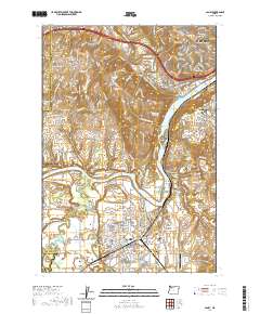
2020 Map of Canby
USGS Topo · Published 2020About this map
Canby and the surrounding Clackamas County landscape are defined by the convergence of major waterways, including the Willamette River, Molalla River, and Pudding River. This recent survey illustrates a complex geography of river bends and islands, such as Willow Island and Rock Island, alongside significant historical markers. Numerous cemeteries including Barlow Pioneer Cem and Baker Prairie Cem point to the deep-rooted settlement of the region, while the presence of French Prairie highlights the area's agricultural heritage south of the river junction.
Find a feature on this map
236 named features on this map. Tap any name to fly to it.
Don’t see what you’re looking for? This feature index may not catch every label — zoom into the map to look around manually.
Map Details
Editions of this 2020 Canby Map
This is the sole edition of this map. No revisions or reprints were ever made.
Other maps of this area

1914 · Oregon City
USGS Topo · 1:62,500

1916 · Tualatin
USGS Topo · 1:62,500

1923 · Mount Angel
USGS Topo · 1:62,500

1939 · Molalla
USGS Topo · 1:62,500

1939 · Oregon City
USGS Topo · 1:62,500

1939 · Tualatin
USGS Topo · 1:62,500

1940 · Tualatin
USGS Topo · 1:62,500

1940 · Molalla
USGS Topo · 1:62,500

1940 · Mount Angel
USGS Topo · 1:62,500

1941 · Oregon City
USGS Topo · 1:62,500