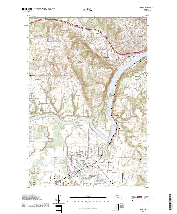
2024 Map of Canby
USGS Topo · Published 2024About this map
The Willamette River and its major tributaries, the Molalla River and Tualatin River, converge in this highly detailed survey of Clackamas County. The geography is defined by a dense network of suburban development and rural heritage, visible in the cluster of burial sites that trace the region's pioneering families, such as the Barlow Pioneer Cem and Baker Prairie Cem. Elevated terrain at Petes Mountain overlooks the complex river bends and eddies, including Walnut Eddy and Fish Eddy. The transportation corridor is anchored by the S.P. Railroad, which parallels the river through settlements like Canby, Barlow, and New Era. This map documents a landscape where agricultural roots and residential growth meet at the southern edge of the Portland metropolitan area, preserving the locations of community landmarks like Zoar Cem and the Stafford Baptist Church.
Find a feature on this map
227 named features on this map. Tap any name to fly to it.
Don’t see what you’re looking for? This feature index may not catch every label — zoom into the map to look around manually.
Map Details
Editions of this 2024 Canby Map
This is the sole edition of this map. No revisions or reprints were ever made.
Other maps of this area

1914 · Oregon City
USGS Topo · 1:62,500

1916 · Tualatin
USGS Topo · 1:62,500

1923 · Mount Angel
USGS Topo · 1:62,500

1939 · Molalla
USGS Topo · 1:62,500

1939 · Oregon City
USGS Topo · 1:62,500

1939 · Tualatin
USGS Topo · 1:62,500

1940 · Tualatin
USGS Topo · 1:62,500

1940 · Molalla
USGS Topo · 1:62,500

1940 · Mount Angel
USGS Topo · 1:62,500

1941 · Oregon City
USGS Topo · 1:62,500