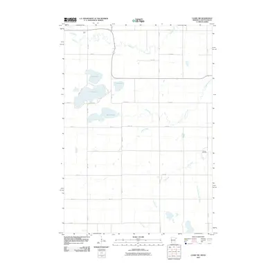
2010 Map of Canby NW
USGS Topo · Published 2010About this map
Lake Cochrane and Lake Oliver anchor the western portion of this prairie landscape, where the headwaters of several drainage systems converge near the Minnesota and South Dakota border. The terrain is defined by its glacial hydrology, featuring the meandering paths of Cobb Creek, Florida Creek, and Lazarus Creek as they cut through the agricultural grid. A notable height of land is found at Stone Hill in the northwest, providing a vantage point over the surrounding lowlands and the South Slough. The rural character is punctuated by long-established landmarks like the Fortier Cemetery, situated near the eastern edge of the quadrangle. Significant water management efforts are evident in the presence of the County Ditch Number Fiftyfive, illustrating how the natural flow of Canby Creek and its tributaries has been adapted for regional land use.
Find a feature on this map
33 named features on this map. Tap any name to fly to it.
Don’t see what you’re looking for? This feature index may not catch every label — zoom into the map to look around manually.
Map Details
Editions of this 2010 Canby NW Map
This is the sole edition of this map. No revisions or reprints were ever made.
Other maps of this area

1953 · Watertown
USGS Topo · 1:250,000

1958 · Watertown
USGS Topo · 1:250,000

1967 · Canby
USGS Topo · 1:24,000

1967 · Gary
USGS Topo · 1:24,000

1967 · Canby NW
USGS Topo · 1:24,000

1967 · Gary SE
USGS Topo · 1:24,000

1967 · Canby SE
USGS Topo · 1:24,000

1967 · Hendricks
USGS Topo · 1:24,000

1970 · Brandt
USGS Topo · 1:24,000

1970 · Astoria
USGS Topo · 1:24,000
Featured Places
- Scandinavia Township, SD
- Herrick Township, SD
- Norden Township, SD
- Yellow Medicine County, MN
- Deuel County, SD