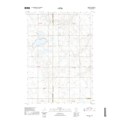
2019 Map of Canby NW
USGS Topo · Published 2019About this map
The Coteau des Prairies plateau dominates this borderland landscape, where the flat agricultural plains of Minnesota meet the glacial uplands of South Dakota. In the northwest corner, a cluster of glacial lakes including Lake Cochrane, Culver Lake, and Lake Oliver provides a distinct contrast to the surrounding section-line road network. The map reveals a heavily managed hydrological system, where natural watercourses like Cobb Cr and Florida Cr are supplemented by the engineered County Ditch Number Fiftyfive. For local historians and genealogists, the Fortier Cem stands as a significant point of interest near the eastern edge of the survey area, documenting the early presence of settlers in this prairie environment. The terrain is marked by numerous small depressions and sloughs, such as the South Slough, characteristic of the region's post-glacial topography.
Find a feature on this map
50 named features on this map. Tap any name to fly to it.
Don’t see what you’re looking for? This feature index may not catch every label — zoom into the map to look around manually.
Map Details
Editions of this 2019 Canby NW Map
This is the sole edition of this map. No revisions or reprints were ever made.
Other maps of this area

1953 · Watertown
USGS Topo · 1:250,000

1958 · Watertown
USGS Topo · 1:250,000

1967 · Canby
USGS Topo · 1:24,000

1967 · Gary
USGS Topo · 1:24,000

1967 · Canby NW
USGS Topo · 1:24,000

1967 · Gary SE
USGS Topo · 1:24,000

1967 · Canby SE
USGS Topo · 1:24,000

1967 · Hendricks
USGS Topo · 1:24,000

1970 · Brandt
USGS Topo · 1:24,000

1970 · Astoria
USGS Topo · 1:24,000
Featured Places
- Scandinavia Township, SD
- Herrick Township, SD
- Norden Township, SD
- Yellow Medicine County, MN
- Deuel County, SD