
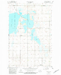
1957 Map of Cando SE
USGS Topo · Published 1958About this map
The lacustrine landscape of central North Dakota is meticulously detailed in this late 1950s survey of the Towner Co Ramsey Co border. A massive hydrologic network dominates the terrain, centering on the Lac Aux Mortes National Wildlife Refuge and the interconnected waters of Chain Lakes, Mikes Lake, and the expansive Dry Lake to the south. The intermittent flow of Mauvais Coulee illustrates the seasonal drainage patterns typical of this prairie pothole region.
Find a feature on this map
17 named features on this map. Tap any name to fly to it.
Don’t see what you’re looking for? This feature index may not catch every label — zoom into the map to look around manually.
Map Details
Editions of this 1957 Cando SE Map
2 editions found
Other maps of this area

1931 · Devils Lake
USGS Topo · 1:62,500

1932 · Grahams Island
USGS Topo · 1:62,500

1950 · Grahams Island
USGS Topo · 1:62,500

1950 · Devils Lake
USGS Topo · 1:62,500

1951 · Tilden
USGS Topo · 1:24,000

1951 · Grand Harbor
USGS Topo · 1:24,000

1951 · Penn
USGS Topo · 1:24,000

1953 · Devils Lake
USGS Topo · 1:250,000

1956 · Devils Lake
USGS Topo · 1:250,000

1957 · Cando
USGS Topo · 1:24,000