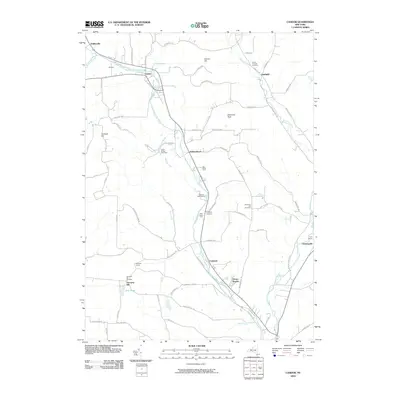
2010 Map of Candor
USGS Topo · Published 2010About this map
Catatonk Creek carves a central path through this Tioga County landscape, defining the corridor between the high ground of Hubbard Hill and Diamond Peak. The village of Candor serves as a primary hub where Cole Brook meets the main waterway, surrounded by upland dairy operations like AA Dairy and specialty agricultural sites including Iron Kettle Farm and Fish Haven Farm. This early 21st-century record captures a rural community organized around valley floors and steep ridge roads, with numerous family-named landmarks and historical burial sites such as Germany Hill Cemetery and Upper Fairfield Cemetery dotting the terrain.
Find a feature on this map
81 named features on this map. Tap any name to fly to it.
Don’t see what you’re looking for? This feature index may not catch every label — zoom into the map to look around manually.
Map Details
Editions of this 2010 Candor Map
This is the sole edition of this map. No revisions or reprints were ever made.
Other maps of this area

1900 · Dryden
USGS Topo · 1:62,500

1901 · Apalachin
USGS Topo · 1:62,500

1903 · Owego
USGS Topo · 1:62,500

1903 · Harford
USGS Topo · 1:62,500

1904 · Apalachin
USGS Topo · 1:62,500

1906 · Catatonk
USGS Topo · 1:125,000

1949 · Willseyville
USGS Topo · 1:24,000

1949 · Speedsville
USGS Topo · 1:24,000

1950 · Elmira
USGS Topo · 1:250,000
1950 · Richford
USGS Topo · 1:24,000