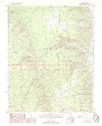
1988 Map of Cane
USGS Topo · Published 1988About this map
Cane Springs and a remote corral mark the sparse human footprint in this high-desert landscape of Coconino County. The terrain is defined by a series of dramatic ridges and canyons, most notably Cane Ridge and Tater Ridge, which separate the drainage of Cane Canyon from the broad expanse of Pleasant Valley. This late-twentieth-century survey reveals the careful management of water in an arid environment, noting features like the Cane Aqueduct and South Rock Tank.
Find a feature on this map
25 named features on this map. Tap any name to fly to it.
Don’t see what you’re looking for? This feature index may not catch every label — zoom into the map to look around manually.
Map Details
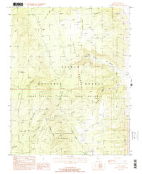
Editions of this 1988 Cane Map
2 editions found
Other maps of this area

1886 · Echo Cliffs
USGS Topo · 1:250,000

1886 · Kaibab
USGS Topo · 1:250,000

1891 · Echo Cliffs
USGS Topo · 1:250,000

1936 · Jacobs Lake
USGS Topo · 1:48,000

1940 · Jacob Lake
USGS Topo · 1:62,500

1953 · Jacobs Lake
USGS Topo · 1:62,500

1953 · Grand Canyon
USGS Topo · 1:250,000

1954 · Emmett Wash NW
USGS Topo · 1:24,000

1954 · Nankoweap
USGS Topo · 1:62,500

1954 · Emmett Wash
USGS Topo · 1:62,500