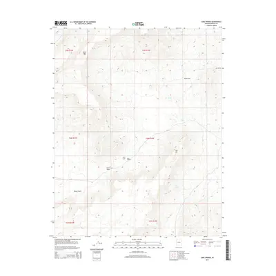
2014 Map of Cane Springs
USGS Topo · Published 2014About this map
Cane Springs and its surrounding water sources provide essential lifelines in this arid corner of the Mojave Desert within Mohave County. The terrain is defined by dramatic elevation changes, from the heights of Black Rock Mtn in the northwest to the distinct peak of Mud Mtn further south. Waterways and drainage patterns like Tom and Cull Wash and the complex of Corral Canyon illustrate how the landscape has been carved over time, while isolated points like Sand Spring and Mud Spring represent the scarce but vital moisture available in this environment.
Find a feature on this map
19 named features on this map. Tap any name to fly to it.
Don’t see what you’re looking for? This feature index may not catch every label — zoom into the map to look around manually.
Map Details
Editions of this 2014 Cane Springs Map
This is the sole edition of this map. No revisions or reprints were ever made.
Other maps of this area

1886 · Mt. Trumbull
USGS Topo · 1:250,000

1892 · Mt. Trumbull
USGS Topo · 1:250,000

1953 · Grand Canyon
USGS Topo · 1:250,000

1954 · Littlefield 3 SW
USGS Topo · 1:24,000

1954 · Littlefield 3 NE
USGS Topo · 1:24,000
1954 · Littlefield 3 SE
USGS Topo · 1:24,000

1954 · Littlefield
USGS Topo · 1:62,500

1954 · Cane Springs
USGS Topo · 1:62,500

1957 · Grand Canyon
USGS Topo · 1:250,000

1958 · Grand Canyon
USGS Topo · 1:250,000