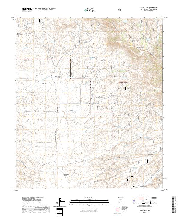
2021 Map of Canelo Pass
USGS Topo · Published 2021About this map
Coronado National Forest dominates this landscape in Santa Cruz County, where the high desert meets the northern reaches of the San Rafael Valley. The map detail reveals an intricate network of ranching and land management infrastructure, characterized by numerous water catchments such as Bog Hole Tank and Headquarters Tank that support livestock and wildlife in this arid environment. The terrain is defined by the sharp elevations of the Canelo Hills and Lookout Knoll, with the Arizona National Scenic Trl winding through the eastern ridges.
Find a feature on this map
53 named features on this map. Tap any name to fly to it.
Don’t see what you’re looking for? This feature index may not catch every label — zoom into the map to look around manually.
Map Details
Editions of this 2021 Canelo Pass Map
This is the sole edition of this map. No revisions or reprints were ever made.
Other maps of this area

1904 · Patagonia
USGS Topo · 1:125,000

1905 · Patagonia
USGS Topo · 1:125,000

1905 · Nogales
USGS Topo · 1:125,000

1914 · Hereford
USGS Topo · 1:125,000

1915 · Benson
USGS Topo · 1:125,000

1922 · Sunnyside
USGS Topo · 1:62,500

1932 · Lochiel
USGS Topo · 1:62,500

1932 · Elgin
USGS Topo · 1:62,500

1938 · Huachuca
USGS Topo · 1:62,500

1938 · Sunnyside
USGS Topo · 1:62,500