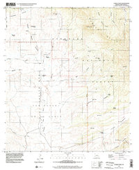
1996 Map of Canelo Pass
USGS Topo · Published 2002About this map
San Rafael Valley dominates the southwestern portion of this topographic survey, showcasing a high-desert landscape defined by seasonal drainages and scattered livestock operations. The transition from the valley floor into the Canelo Hills and Coronado National Forest is marked by a network of ranching infrastructure, including several named tanks such as Bog Hole Tank and Williamson Tank. The area is notably rural, with human activity centered around private land holdings like the Little Outfit Ranch, Vaca Ranch, and Ki-He-Kah Ranch.
Find a feature on this map
43 named features on this map. Tap any name to fly to it.
Don’t see what you’re looking for? This feature index may not catch every label — zoom into the map to look around manually.
Map Details
Editions of this 1996 Canelo Pass Map
This is the sole edition of this map. No revisions or reprints were ever made.
Other maps of this area

1904 · Patagonia
USGS Topo · 1:125,000

1905 · Patagonia
USGS Topo · 1:125,000

1905 · Nogales
USGS Topo · 1:125,000

1914 · Hereford
USGS Topo · 1:125,000

1915 · Benson
USGS Topo · 1:125,000

1922 · Sunnyside
USGS Topo · 1:62,500

1932 · Lochiel
USGS Topo · 1:62,500

1932 · Elgin
USGS Topo · 1:62,500

1938 · Huachuca
USGS Topo · 1:62,500

1938 · Sunnyside
USGS Topo · 1:62,500