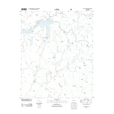
2011 Map of Caney Creek
USGS Topo · Published 2011About this map
The Ocoee River defines the northern landscape of this region, serving as the backdrop for the small settlement of Caney Creek and the infrastructure of the Ocoee Flume. This survey illustrates a terrain of high ridges and deep hollows, where the timber and recreation economies intersect. To the south, the community of Sylco and the Sylco Campground are situated near the junction of Sylco Creek Rd and numerous mountain trails. Genealogists and local researchers will find several family and community burial sites scattered across the ridges, including Price Cemetery, Beckler Cemetery, and Old Fairview Cemetery. The map also captures specialized facilities like the Thornburg Shooting Range and the Camp Cherokee Organization Camp, reflecting the area's use for managed outdoor recreation and forest service operations.
Find a feature on this map
95 named features on this map. Tap any name to fly to it.
Don’t see what you’re looking for? This feature index may not catch every label — zoom into the map to look around manually.
Map Details
Editions of this 2011 Caney Creek Map
This is the sole edition of this map. No revisions or reprints were ever made.
Other maps of this area

1886 · Dalton
USGS Topo · 1:125,000

1886 · Cleveland
USGS Topo · 1:125,000

1888 · Ellijay
USGS Topo · 1:125,000

1892 · Cleveland
USGS Topo · 1:125,000

1892 · Ellijay
USGS Topo · 1:125,000

1892 · Dalton
USGS Topo · 1:125,000

1893 · Murphy
USGS Topo · 1:125,000

1895 · Cleveland
USGS Topo · 1:125,000

1897 · Dalton
USGS Topo · 1:125,000

1898 · Ellijay
USGS Topo · 1:125,000