
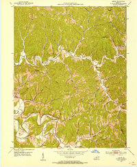
1951 Map of Cannel City
USGS Topo · Published 1952About this map
Cannel City serves as a focal point in this 1951 survey of eastern Kentucky, where the complex topography of the Cumberland Plateau dictates the pattern of settlement and transport. Roads and communities cling to the narrow valley floors of the Red River, Caney Creek, and Grassy Creek. The map document an intricate network of local identifiers including Buskirk (P O), Insko (PO), and Wells Station. This era shows the landscape before modern highway expansion, where rural life revolved around local institutions like the Halsey Sch, Salem Ch, and Grassy Lick Ch. Numerous family-named burial grounds, such as the Ferguson Cem, De Board Cem, and Wells Cem, are peppered throughout the hollows, offering a detailed record for genealogical research in Morgan and Wolfe counties. Prominent high points like Testerman Knob and Pilot Knob provide orientation across the heavily dissected terrain.
Find a feature on this map
84 named features on this map. Tap any name to fly to it.
Don’t see what you’re looking for? This feature index may not catch every label — zoom into the map to look around manually.
Map Details
Editions of this 1951 Cannel City Map
This is the sole edition of this map. No revisions or reprints were ever made.
Other maps of this area

1889 · Salyersville
USGS Topo · 1:125,000

1891 · Salyersville
USGS Topo · 1:125,000

1899 · Salyersville
USGS Topo · 1:125,000

1950 · Lenox
USGS Topo · 1:24,000

1951 · Landsaw
USGS Topo · 1:24,000

1951 · White Oak
USGS Topo · 1:24,000

1951 · Ezel
USGS Topo · 1:24,000

1951 · Hazel Green
USGS Topo · 1:24,000
1951 · Lenox
USGS Topo · 1:24,000

1951 · Seitz
USGS Topo · 1:24,000