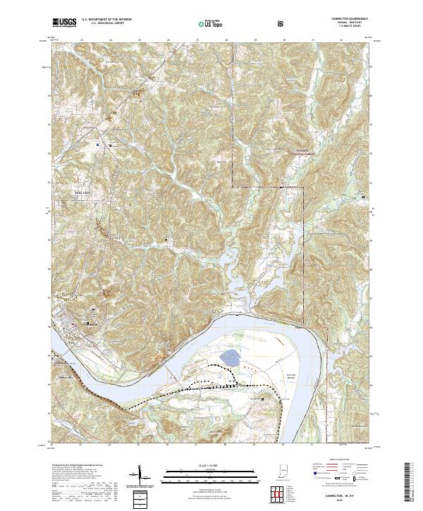
2022 Map of Cannelton
USGS Topo · Published 2022About this map
Cannelton and Tell City anchor this reach of the Ohio River, where the industrial and residential centers of Perry County meet the wooded uplands of the Hoosier National Forest. The map documents a landscape defined by sharp elevation changes, from the alluvial plains of Sterretts Bottom to the high points of Chilton Hill and Jeffry Cliff. Researchers will find several significant burial sites across the ridges, including the Log Church Cem near Deer Creek and Saint Michaels Cem overlooking the river valley.
Find a feature on this map
136 named features on this map. Tap any name to fly to it.
Don’t see what you’re looking for? This feature index may not catch every label — zoom into the map to look around manually.
Map Details
Editions of this 2022 Cannelton Map
This is the sole edition of this map. No revisions or reprints were ever made.
Other maps of this area

1900 · St Meinrad
USGS Topo · 1:62,500

1903 · St. Meinrad
USGS Topo · 1:62,500

1903 · Tell City
USGS Topo · 1:62,500

1934 · Cannelton
USGS Topo · 1:62,500

1949 · Cannelton
USGS Topo · 1:24,000

1953 · Cannelton
USGS Topo · 1:24,000

1953 · Cloverport
USGS Topo · 1:24,000

1953 · Tell City
USGS Topo · 1:24,000
1953 · Mattingly
USGS Topo · 1:24,000
1953 · Rome
USGS Topo · 1:24,000