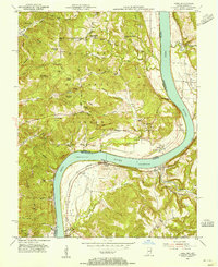
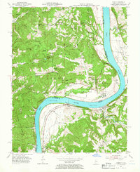
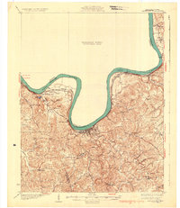
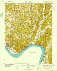
1953 Map of Rome
USGS Topo · Published 1955About this map
The Ohio River carves a dramatic oxbow through the borderlands of Indiana and Kentucky, defining the lives of riverside communities like Rome and Stephensport in the mid-1950s. The northern bank is dominated by the dense canopy of the Hoosier National Forest, where the German Ridge Lookout Tower stands as a sentinel over rugged ridges such as Popo Ridge and Shove Ridge. This topography is marked by numerous family-named landmarks and cemeteries, including Brashear Cem and Groves Cem, which offer significant value for genealogical research.
Find a feature on this map
79 named features on this map. Tap any name to fly to it.
Don’t see what you’re looking for? This feature index may not catch every label — zoom into the map to look around manually.
Map Details
Editions of this 1953 Rome Map
2 editions found
Other maps of this area
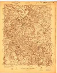
1928 · Hardinsburg
USGS Topo · 1:48,000
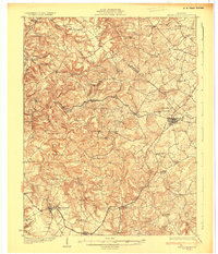
1931 · Hardinsburg
USGS Topo · 1:62,500
1934 · Cannelton
USGS Topo · 1:62,500
1947 · Lodiburg
USGS Topo · 1:24,000
1947 · Hardinsburg
USGS Topo · 1:24,000
1947 · Hardinsburg
USGS Topo · 1:62,500
1949 · Cannelton
USGS Topo · 1:24,000
1950 · Alton
USGS Topo · 1:62,500
1950 · Alton
USGS Topo · 1:24,000

1951 · Alton
USGS Topo · 1:24,000