
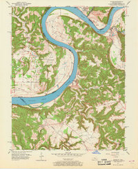
1951 Map of Alton
USGS Topo · Published 1951About this map
The Ohio River carves a massive horseshoe at Little Bend in this early 1950s survey of the Indiana-Kentucky border. On the Indiana side, the small settlement of Alton sits at the confluence with the Little Blue River, while the Kentucky shoreline is marked by more isolated landing points like Magnet and Concordia. This map captures a landscape defined by river transport and Catholic institutional history, notably featuring St Theresa Academy and Sacred Heart Ch in the uplands of Union and the surrounding hills. Family-named landmarks such as Stephenson Cem and Jarbo Sinks provide important clues for genealogists tracking rural homesteads. The presence of the Boyer Ferry and the Meade Co Ferry illustrates how communities remained connected across the river before modern bridge infrastructure dominated the region.
Find a feature on this map
42 named features on this map. Tap any name to fly to it.
Don’t see what you’re looking for? This feature index may not catch every label — zoom into the map to look around manually.
Map Details
Editions of this 1951 Alton Map
2 editions found
Other maps of this area

1928 · Hardinsburg
USGS Topo · 1:48,000

1931 · Hardinsburg
USGS Topo · 1:62,500

1934 · Cannelton
USGS Topo · 1:62,500

1946 · Leavenworth
USGS Topo · 1:24,000

1947 · Irvington
USGS Topo · 1:24,000

1947 · Lodiburg
USGS Topo · 1:24,000

1947 · Leavenworth
USGS Topo · 1:24,000

1947 · Hardinsburg
USGS Topo · 1:62,500

1950 · Beechwood
USGS Topo · 1:24,000
1950 · Leavenworth
USGS Topo · 1:24,000