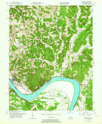
1953 Map of Cannelton
USGS Topo · Published 1964About this map
Cannelton, Indiana and Hawesville, Kentucky face each other across a wide bend in the Ohio River during the mid-1950s. This survey records the distinct settlement patterns of both states, from the concentrated urban grid of Cannelton near St Michael Ch to the dispersed rural communities tucked into the ridges and hollows of the Hoosier National Forest area. The landscape is defined by its dramatic relief, where Lutgring Ridge and Chilton Hill separate drainages like Deer Creek and Brushy Fork.
Find a feature on this map
54 named features on this map. Tap any name to fly to it.
Don’t see what you’re looking for? This feature index may not catch every label — zoom into the map to look around manually.
Map Details
Editions of this 1953 Cannelton Map
3 editions found
Other maps of this area

1900 · St Meinrad
USGS Topo · 1:62,500

1903 · St. Meinrad
USGS Topo · 1:62,500

1903 · Tell City
USGS Topo · 1:62,500

1934 · Cannelton
USGS Topo · 1:62,500

1949 · Cannelton
USGS Topo · 1:24,000

1953 · Cannelton
USGS Topo · 1:24,000

1953 · Cloverport
USGS Topo · 1:24,000

1953 · Tell City
USGS Topo · 1:24,000
1953 · Mattingly
USGS Topo · 1:24,000
1953 · Rome
USGS Topo · 1:24,000