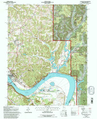
1993 Map of Cannelton
USGS Topo · Published 1996About this map
The Ohio River defines the geography of this border region where Tell City and Cannelton anchor the Indiana shore across from Hawesville, Kentucky. Significant river infrastructure is visible at the Cannelton Locks and Dam, while the surrounding terrain is a network of ridges and hollows including Lockner Ridge and Funk Hollow. Much of the eastern portion is protected within the Hoosier National Forest, reflecting a landscape transitioning from riverfront industry to managed woodland.
Find a feature on this map
67 named features on this map. Tap any name to fly to it.
Don’t see what you’re looking for? This feature index may not catch every label — zoom into the map to look around manually.
Map Details
Editions of this 1993 Cannelton Map
This is the sole edition of this map. No revisions or reprints were ever made.
Other maps of this area

1900 · St Meinrad
USGS Topo · 1:62,500

1903 · St. Meinrad
USGS Topo · 1:62,500

1903 · Tell City
USGS Topo · 1:62,500

1934 · Cannelton
USGS Topo · 1:62,500

1949 · Cannelton
USGS Topo · 1:24,000

1953 · Cannelton
USGS Topo · 1:24,000

1953 · Cloverport
USGS Topo · 1:24,000

1953 · Tell City
USGS Topo · 1:24,000
1953 · Mattingly
USGS Topo · 1:24,000
1953 · Rome
USGS Topo · 1:24,000