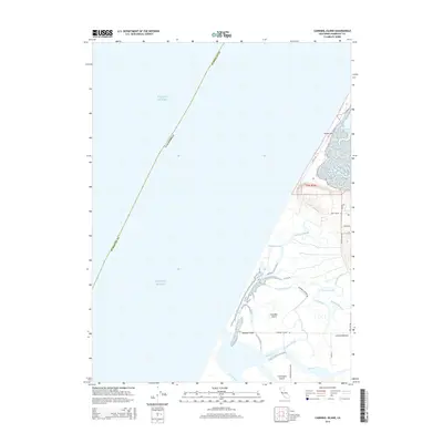
2015 Map of Cannibal Island
USGS Topo · Published 2015About this map
The delta of the Eel River and its intricate network of coastal waterways define this coastal region of Humboldt County. Low-lying landforms such as Cannibal Island, Mosley Island, and Cock Robin Island are separated by a complex system of sloughs, including Sevenmile Slough, McNulty Slough, and Hawk Slough. This landscape is primarily shaped by the intersection of freshwater drainage and the tidal influence of the Pacific Ocean, which meets the shore along the narrow South Spit. In the eastern section, Loleta Bottoms represents the agricultural character of the river valley, while the rise of Table Bluff provides a distinct change in elevation above the marshy lowlands. Local transport is reflected in family and place-named routes like Copenhagen Rd, Cannibal Island Rd, and Quinn Rd, tracing the early settlement patterns of this tidal basin.
Find a feature on this map
28 named features on this map. Tap any name to fly to it.
Don’t see what you’re looking for? This feature index may not catch every label — zoom into the map to look around manually.
Map Details
Editions of this 2015 Cannibal Island Map
This is the sole edition of this map. No revisions or reprints were ever made.
Other maps of this area

1916 · Cape Fortunas
USGS Topo · 1:62,500

1922 · Eureka
USGS Topo · 1:62,500

1933 · Eureka
USGS Topo · 1:48,000

1942 · Eureka
USGS Topo · 1:62,500

1943 · Ferndale
USGS Topo · 1:62,500

1944 · Fortuna
USGS Topo · 1:62,500

1949 · Eureka
USGS Topo · 1:250,000

1951 · Eureka
USGS Topo · 1:62,500

1951 · Ferndale
USGS Topo · 1:62,500
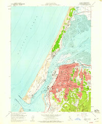
1958 · Eureka
USGS Topo · 1:24,000