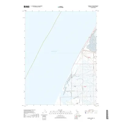
2018 Map of Cannibal Island
USGS Topo · Published 2018About this map
Cannibal Island and the surrounding marshlands of the Eel River delta define this coastal landscape where fresh and salt water meet. In this 2018 survey, the intricate network of tidal channels including McNulty Slough, Sevenmile Slough, and Ropers Slough illustrates the complex hydrology of the region south of Humboldt Bay. The map details the low-lying island topography of Mosley Island and Cock Robin Island, which are hemmed in by the Salt River and the Pacific coast. Cultural features are concentrated along the eastern edge and the South Spit, with rural routes like Copenhagen Rd and Table Bluff Rd providing access to the wetlands. This record of the coastal environment captures the intersection of traditional land use and natural drainage patterns, showing how the river delta remains dominated by its sloughs and seasonal inundation zones.
Find a feature on this map
30 named features on this map. Tap any name to fly to it.
Don’t see what you’re looking for? This feature index may not catch every label — zoom into the map to look around manually.
Map Details
Editions of this 2018 Cannibal Island Map
This is the sole edition of this map. No revisions or reprints were ever made.
Other maps of this area

1916 · Cape Fortunas
USGS Topo · 1:62,500

1922 · Eureka
USGS Topo · 1:62,500

1933 · Eureka
USGS Topo · 1:48,000

1942 · Eureka
USGS Topo · 1:62,500

1943 · Ferndale
USGS Topo · 1:62,500

1944 · Fortuna
USGS Topo · 1:62,500

1949 · Eureka
USGS Topo · 1:250,000

1951 · Eureka
USGS Topo · 1:62,500

1951 · Ferndale
USGS Topo · 1:62,500
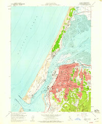
1958 · Eureka
USGS Topo · 1:24,000