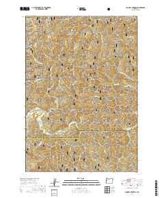
2020 Map of Cannibal Mountain
USGS Topo · Published 2020About this map
Siuslaw National Forest encompasses the entirety of this landscape, dominated by a complex network of coastal ridges and river forks. The topography is defined by prominent elevations such as Cannibal Mtn and Burnt Timber Mtn, which overlook a dense drainage system feeding into the Yachats River. This modern survey illustrates the rugged interior of the Oregon Coast Range, where numerous tributaries like Canal Cr and Buck Cr carve through steep terrain. The map traces the intricate boundary between Lincoln Co and Lane Co, following the natural divides between the South Fork and North Fork systems. Researchers can identify high-elevation landmarks such as Howell Ridge, Seits Ridge, and the secluded clearing of Durbin Meadows, providing a clear view of the forest's structural landforms and historical surveying lines.
Find a feature on this map
37 named features on this map. Tap any name to fly to it.
Don’t see what you’re looking for? This feature index may not catch every label — zoom into the map to look around manually.
Map Details
Editions of this 2020 Cannibal Mountain Map
This is the sole edition of this map. No revisions or reprints were ever made.
Other maps of this area

1918 · Mapleton
USGS Topo · 1:48,000

1920 · Heceta Head
USGS Topo · 1:62,500

1922 · Waldport
USGS Topo · 1:62,500

1940 · Mapleton
USGS Topo · 1:62,500

1942 · Waldport
USGS Topo · 1:62,500

1942 · Heceta Head
USGS Topo · 1:62,500

1942 · Tidewater
USGS Topo · 1:62,500

1945 · Mapleton
USGS Topo · 1:62,500

1953 · Salem
USGS Topo · 1:250,000

1954 · Salem
USGS Topo · 1:250,000