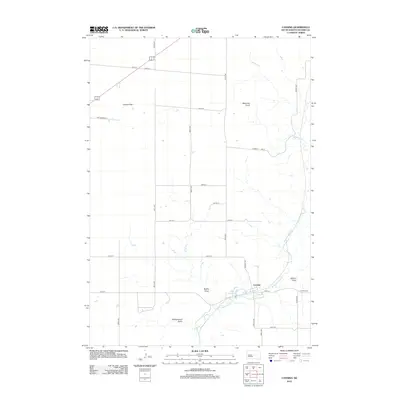
2012 Map of Canning
USGS Topo · Published 2012About this map
Canning sits at the intersection of rural South Dakota roads and the wandering course of Medicine Knoll Cr in this Hughes County landscape. The settlement is defined by its proximity to notable water features and distinct drainage patterns, including Lake Chesley and the broad Brekke Draw to the west. The terrain reveals the character of the Missouri River plateau, moving from the level expanse of Gumbo Flat in the northwest to the prominent elevation of Medicine Knoll.
Find a feature on this map
28 named features on this map. Tap any name to fly to it.
Don’t see what you’re looking for? This feature index may not catch every label — zoom into the map to look around manually.
Map Details
Editions of this 2012 Canning Map
This is the sole edition of this map. No revisions or reprints were ever made.
Other maps of this area

1934 · Canning
USGS Topo · 1:48,000

1937 · Canning
USGS Topo · 1:62,500

1953 · Huron
USGS Topo · 1:250,000

1954 · Pierre
USGS Topo · 1:250,000

1954 · Huron
USGS Topo · 1:250,000

1958 · Pierre
USGS Topo · 1:250,000

1967 · Canning
USGS Topo · 1:24,000

1967 · Onida SE
USGS Topo · 1:24,000

1967 · Onida SW
USGS Topo · 1:24,000
1967 · Canning NW
USGS Topo · 1:24,000