
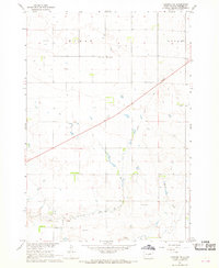
1967 Map of Canning
USGS Topo · Published 1968About this map
Medicine Knoll rises prominently above the surrounding plains, serving as a significant landmark in this section of Hughes County. The landscape is deeply incised by the Medicine Knoll Valley, where the Medicine Knoll Creek winds toward its eventual confluence with the Missouri River just beyond the sheet's edge. The small settlement of Canning is situated along the Chicago and North Western railroad line, positioned near the banks of Lake Chesley. This area reflects a mid-century agricultural and transit corridor, defined by the systematic sectioning of Logan and the prominent Old Indian Treaty Boundary that cuts across the southern portion of the map. Local drainage features like Hiddenwood Gulch, Brekke Draw, and Dehart Draw illustrate the erosion patterns characteristic of the region’s geography during the late 1960s.
Find a feature on this map
14 named features on this map. Tap any name to fly to it.
Don’t see what you’re looking for? This feature index may not catch every label — zoom into the map to look around manually.
Map Details
Editions of this 1967 Canning Map
This is the sole edition of this map. No revisions or reprints were ever made.
Other maps of this area

1934 · Canning
USGS Topo · 1:48,000

1937 · Canning
USGS Topo · 1:62,500

1953 · Huron
USGS Topo · 1:250,000

1954 · Pierre
USGS Topo · 1:250,000

1954 · Huron
USGS Topo · 1:250,000

1958 · Pierre
USGS Topo · 1:250,000

1967 · Onida SE
USGS Topo · 1:24,000

1967 · Onida SW
USGS Topo · 1:24,000
1967 · Canning NW
USGS Topo · 1:24,000

1967 · Blunt
USGS Topo · 1:24,000