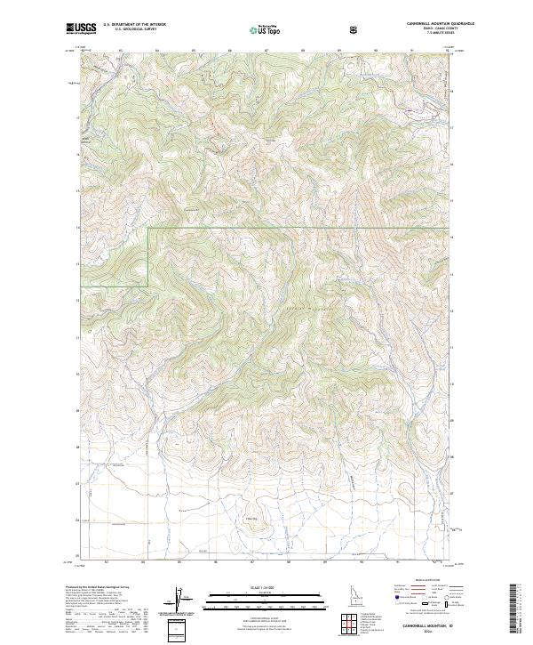
2024 Map of Cannonball Mountain
USGS Topo · Published 2024About this map
Cannonball Mtn and the surrounding Soldier Mountains dominate this high-altitude landscape of central Idaho. The region is defined by a dense network of drainages and seasonal watercourses, including Little Deer Creek and Hot Spring Creek, which carve through the steep terrain. Remote backcountry access is provided by primitive routes such as the Liberal Loop Jeep Trl and Wood Gulch Jeep Trl, tracing the paths of old forest service and ranching tracks. In the southeastern corner of the quadrangle, the Elk Creek Hot Spring serves as a notable landmark along Elk Creek. To the south, the topography softens slightly near Cline Hill, where a more established road network including Deer Creek Rd and Wilson Rd facilitates movement through the mountain valleys.
Find a feature on this map
44 named features on this map. Tap any name to fly to it.
Don’t see what you’re looking for? This feature index may not catch every label — zoom into the map to look around manually.
Map Details
Editions of this 2024 Cannonball Mountain Map
This is the sole edition of this map. No revisions or reprints were ever made.
Other maps of this area

1900 · Sawtooth
USGS Topo · 1:125,000

1955 · Hailey
USGS Topo · 1:250,000

1957 · Fairfield
USGS Topo · 1:62,500

1957 · Blaine
USGS Topo · 1:62,500

1959 · Hailey
USGS Topo · 1:250,000

1962 · Hailey
USGS Topo · 1:250,000

1970 · Sydney Butte
USGS Topo · 1:24,000

1970 · Dollarhide Mtn
USGS Topo · 1:24,000
1970 · Buttercup Mtn
USGS Topo · 1:24,000
1986 · Phillips
USGS Topo · 1:24,000