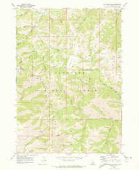
1970 Map of Buttercup Mtn
USGS Topo · Published 1973About this map
The Sawtooth National Forest dominates this 1970 study of the high-elevation drainage systems between the Smoky Mountains and the surrounding Idaho peaks. Mining history is a central theme of this landscape, evidenced by the presence of the Buttercup Mine and various unnamed mines and prospects scattered near the Buttercup Creek headwaters. The map records a transition point in the local economy, where early extractive efforts are marked by Ruins and established claim sites near the Blaine and Camas county lines.
Find a feature on this map
40 named features on this map. Tap any name to fly to it.
Don’t see what you’re looking for? This feature index may not catch every label — zoom into the map to look around manually.
Map Details
Editions of this 1970 Buttercup Mtn Map
2 editions found
Other maps of this area

1895 · Hailey
USGS Topo · 1:125,000

1897 · Hailey
USGS Topo · 1:125,000

1900 · Sawtooth
USGS Topo · 1:125,000

1955 · Hailey
USGS Topo · 1:250,000

1957 · Bellevue
USGS Topo · 1:62,500

1957 · Blaine
USGS Topo · 1:62,500

1959 · Hailey
USGS Topo · 1:250,000

1962 · Hailey
USGS Topo · 1:250,000

1967 · Mahoney Butte
USGS Topo · 1:24,000
1967 · Griffin Butte
USGS Topo · 1:24,000