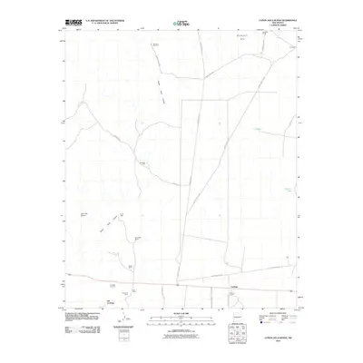
2010 Map of Canon Agua Buena
USGS Topo · Published 2010About this map
Old Carthage and Carthage represent the primary points of historical interest in this desert landscape, where coal mining and ranching legacies are deeply etched into the topography. The presence of the Hart Coal Mine and Hart Mine near the southern boundary, alongside the isolated Law Mine to the north, indicates an economy once driven by mineral extraction. Family ranching operations, including the Del Curto Ranch, Fernandez Ranch, Muncy Ranch, and Padilla Ranch, are distributed across the arid terrain, often centered around water sources like Gonzales Well and Araya Well. The map also details extensive transportation networks associated with the White Sands Missile Range, notably WSMR P Route 5 and WSMR S Route 3807, which cut through the Blackington Hills. Along the southern corridor, the Carthage Cemetery serves as a quiet marker of the community's ancestral roots near the seasonal drainage of the San Pedro Arroyo.
Find a feature on this map
35 named features on this map. Tap any name to fly to it.
Don’t see what you’re looking for? This feature index may not catch every label — zoom into the map to look around manually.
Map Details
Editions of this 2010 Canon Agua Buena Map
This is the sole edition of this map. No revisions or reprints were ever made.
Other maps of this area

1906 · Socorro
USGS Topo · 1:62,500

1916 · La Joya
USGS Topo · 1:125,000

1948 · Carthage
USGS Topo · 1:62,500

1948 · San Antonio
USGS Topo · 1:62,500

1954 · Tularosa
USGS Topo · 1:250,000

1954 · Socorro
USGS Topo · 1:250,000

1958 · Socorro
USGS Topo · 1:250,000

1958 · Tularosa
USGS Topo · 1:250,000

1959 · Loma De Las Canas
USGS Topo · 1:24,000

1959 · Socorro
USGS Topo · 1:62,500