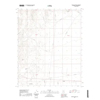
2020 Map of Canon Agua Buena
USGS Topo · Published 2020About this map
Old Carthage and the nearby settlement of Carthage anchor the southern portion of this high-desert landscape in Socorro County. This 2020 topographic survey illustrates a region shaped by a transition from early settlement to modern government use, evidenced by the numerous White Sands Missile Range routes crisscrossing the terrain, such as WSMR P Route 5 and WSMR S Route 3606. Genealogists and local historians will find the Carthage Cem particularly significant, situated just north of the original townsite along the banks of the San Pedro Arroyo. To the north, the terrain rises into the Blackington Hills and the prominent Cerro del Viboro, while the Cañon Agua Buena carves a deep path through the southwestern quadrangle. The presence of water sources like CC Tank and Triple A Tank underscores the importance of water management in this arid environment, providing a clear picture of the land's infrastructure and natural topography.
Find a feature on this map
23 named features on this map. Tap any name to fly to it.
Don’t see what you’re looking for? This feature index may not catch every label — zoom into the map to look around manually.
Map Details
Editions of this 2020 Canon Agua Buena Map
This is the sole edition of this map. No revisions or reprints were ever made.
Other maps of this area

1906 · Socorro
USGS Topo · 1:62,500

1916 · La Joya
USGS Topo · 1:125,000

1948 · Carthage
USGS Topo · 1:62,500

1948 · San Antonio
USGS Topo · 1:62,500

1954 · Tularosa
USGS Topo · 1:250,000

1954 · Socorro
USGS Topo · 1:250,000

1958 · Socorro
USGS Topo · 1:250,000

1958 · Tularosa
USGS Topo · 1:250,000

1959 · Loma De Las Canas
USGS Topo · 1:24,000

1959 · Socorro
USGS Topo · 1:62,500